

Cibola Wilderness – Image Gallery


Cibola Wilderness
The Cibola Wilderness in New Mexico is a rugged and remote area characterized by deep canyons, towering cliffs, and diverse wildlife.
Details
Cibola Wilderness
The Cibola Wilderness is located in western New Mexico and covers approximately 33,000 acres of pristine wilderness. This area is known for its diverse landscapes, including rugged canyons, towering cliffs, and lush forests. The wilderness is part of the Cibola National Forest and is managed by the U.S. Forest Service. One of the defining features of the Cibola Wilderness is the dramatic sandstone cliffs that rise up from the surrounding landscape. These cliffs provide habitat for a variety of wildlife, including golden eagles, peregrine falcons, and mule deer. The area is also home to a number of rare plant species, making it an important ecological area. The wilderness is crisscrossed by several hiking trails that offer stunning views of the surrounding landscape. Visitors can explore deep canyons, crystal-clear streams, and hidden waterfalls as they hike through the wilderness. Camping is allowed in designated areas, providing a unique opportunity to experience the wilderness up close. Overall, the Cibola Wilderness is a unique and valuable ecological area in New Mexico. Its diverse landscapes, rich wildlife, and recreational opportunities make it a popular destination for outdoor enthusiasts and nature lovers alike.Cibola Wilderness
Points of Interest
Cibola Wilderness Points of Interest
Bluewater Creek
Bluewater Creek is a popular spot for hiking, fishing, and wildlife viewing. The creek is home to a variety of bird species, including herons and egrets. Visitors can also enjoy picnicking along the banks of the creek.
Mount Taylor
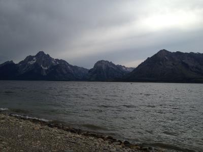
Mount Taylor is the highest peak in the Cibola Wilderness and offers stunning panoramic views of the surrounding landscape. Hikers can tackle the challenging summit trail or opt for a more leisurely hike around the base of the mountain.
El Malpais National Monument
Located just outside the Cibola Wilderness, El Malpais National Monument is a must-see destination for visitors. The area features unique volcanic landscapes, including lava flows, cinder cones, and ancient lava tubes. Visitors can explore the area on foot or horseback.
Acoma Pueblo
Acoma Pueblo is one of the oldest continuously inhabited communities in North America. The pueblo sits atop a mesa and offers guided tours of its historic buildings, kivas, and pottery studios. Visitors can learn about the rich cultural heritage of the Acoma people.
Grants, New Mexico
Grants is the gateway to the Cibola Wilderness and offers a variety of amenities for visitors, including restaurants, lodging, and outdoor recreation outfitters. The town is also home to the New Mexico Mining Museum, where visitors can learn about the region's mining heritage.
Cibola Wilderness – Images

Description: Spray settling in the canyons after the plane's pass. Tussock moth spray job, Sandia Mountains, Cibola National Forest, New Mexico. Photo by: Dick Kent Date: June 1960 Credit: National Archives and Records Administration RG# 95-GP.Records of the Forest Service. General Subject Files. USDA Forest Service Negative Number: 495024 NARA image: 95-GP-5043-Box0855_003_001_AC For related historic forest entomology photos, stories, and resources see the Western Forest Insect Work Conference site: <a href="http://wfiwc.org/content/history-and-resources" rel="nofollow">wfiwc.org/content/history-and-resources</a> Image provided by USDA Forest Service, R6, State and Private Forestry, Forest Health Protection: <a href="https://www.fs.usda.gov/main/r6/forest-grasslandhealth/" rel="nofollow">www.fs.usda.gov/main/r6/forest-grasslandhealth/</a>.
Image by R6, State & Private Forestry, Forest Health Protection – Public domain – Wikimedia

Description: The Apache Kid Wilderness in the Cibola National Forest.
Image by US Forest Service – Public domain – Wikimedia

Description: A map of the San Mateo Mountains — within the Cibola National Forest, located in Cibola and Socorro Counties, New Mexico. Showing the Apache Kid Wilderness and Withington Wilderness Areas (in Socorro County). The map also indicates the locations of the Cibola National Forest's Inventoried Roadless Areas.
Image by CibolaLover – CC BY-SA 3.0 – Wikimedia

Search
Quick Links
New Blog SystemNational Parks (NEW)
National Forests (NEW)
National Monuments (NEW)
National Recreation Areas
State Parks
Bureau of Land Management (BLM) Areas
Wilderness Areas (NEW)
By The Numbers (NEW)
- Populations of all Countries (NEW)
Ideas - Stock Tickers
Running USA Debt Total